 |
| I bumped into Frank at Wolf Stones, the first time I've seen anyone else up there, and he kindly posed for this shot to give a sense of scale |
Distance: 7 miles
Ascent: 870 ft
Walking: Andrew
Weather: Overcast.
OS Map: OL21 - South Pennines
Starting point: Oldfield Lane, Oakworth.
Photography: Andrew using Nikon D750 / Nikon 24-70 f2.8 mm
More-or-less the same walk as I did a couple of weeks ago but this time the sun was out and the heather was starting to go over and the rose bay willow herb and thistles had gone to seed.
 |
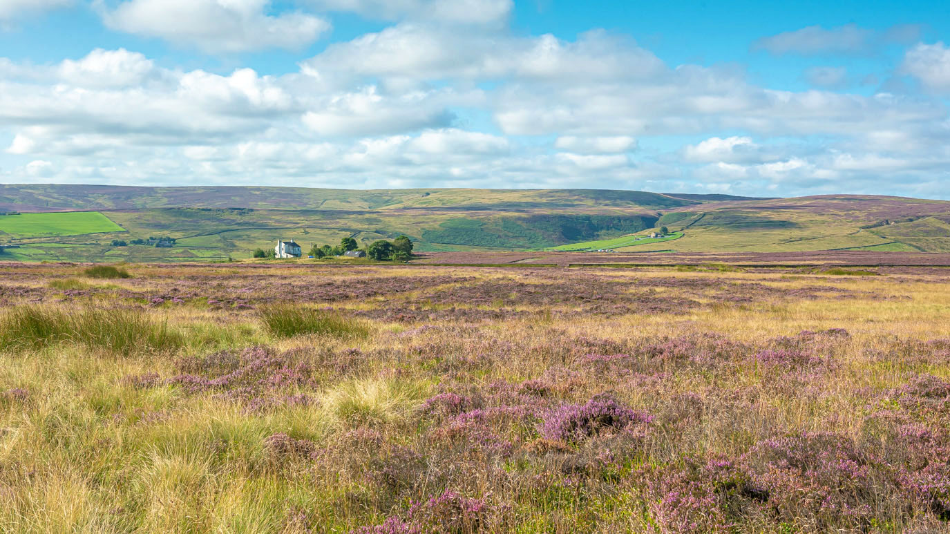
The view from my starting point at Oldfield School, looking over the valley to Harbour Lodge.
|
|
 |
Ponden Reservoir, with Top Withens and Ponden Kirk in the distance.
|
|
 |
Ponden Kirk and Moor Lodge from Pinewood Lodge.
|
|
 |
Heading up onto Oakworth Moor alongside Pinewood.
|
|
 |
The path ahead follows the wall for about a mile, all the way to the Pennine Way but it is always very boggy and sometimes treacherous, so I hopped over the stile on the right and headed up onto the moor.
|
|
 |
An abandoned quarry pit, one of many around here. You have to be a bit careful where you tread because the path isn't easy to follow at this point. The old quarry track is just about discernible but it's completely overgrown and the tufty grasses and heather make it quite hard to walk on.
|
|
 |
Looking towards Crow hill, the heather is a mixture of fresh purple flowers and the russet tones of the flowers that have gone over.
|
|
 |
There are many different types of grass up here but the soft rush is the most easily identifiable.
|
|
 |
There are loads of grouse shooting butts on this part of the moor but they don't appear to have been maintained this year.
|
|
 |
An old (probably 18th /19th century) parish boundary stone.
|
|
 |
Looking back towards Oakworth.
|
|
 |
Old Bess is the stone on the left.
|
|
 |
Yep, it's another boundary stone.
|
|
 |
This boggy area is known as The Sea.
|
|
 |
There were loads of dragonflies flitting around the pool. I only had my 24 - 70 mm lens with me today so couldn't get any closer, sadly
|
|
 |
The trig point above Wolf Stones, 1450ft above sea level.
|
|
 |
From here, you get a 360 degree panorama across 3 counties.
|
|
 |
Wolf Stones sit at the point where West Yorkshire, Lancashire and North Yorkshire meet and they great views over Watersheddles Reservoir, Crow Hill and Pendle Hill.
|
|
 |
The view across Emmott Moor, on the Lancashire side, to Pendle Hill from the top of Great Wolf Stones.
|
|
 |
Looking back over Oakworth Moor from Little Wolf Stones.
|
|
 |
Back on the Pennine Way, heading towards Ickornshaw Moor, searching in vain for the path across Emmott Moor to Wycoller, so I turned and headed back the way I'd come.
|
|
 |
Thrange of colours on the moors this time of year is amazing and the blue sky reflecting in the bog just added to that.
|
|
 |
Nice to see the red grass has started to appear, slightly later this year. Very little cotton grass compared with last year, though.
|
|
 |
Looking back again across to the trig point at Wolf Stones.
|
|
 |
The sunlight really enhances the vibrant colours.
|
|
 |
Stony Edge New Delph (I didn't go in this week).
|
|
 |
This wispy golden grass floating in the breeze caught my eye.
|
|
 |
Plenty of thistledown today.
|
|
 |
It would be rude to pass this abandoned dumper truck without taking a few shots. There's another one in a much more remote location nearby at White Reaps Clough.
|
|
 |
I took a similar shot here 2 weeks ago when the heather and the rose bay willow herb were in full flower. It's surprising how much it's changed in that short time.
|
|
 |
You can never have too much thistledown.
|
|
 |
Lone rowan at Dean Clough.
|
|
 |
The beautiful Worth Valley bathed in sunlight.
|
|
 |
Ponden Reservoir and Ponden Hall.
|
|
 |
Bridleway down to Higher Pitcher Clough.
|
|
 |
Yet more thistledown in Oldfield.
|
|
 |
Fantastic view across the valley to Stanbury from the row of cottages next to Oldfield School.
|
|


