 |
| The access track to Bottoms Farm with Slippery Ford and Keighley Moor in the distance |
Distance: 9 miles
Ascent: 990 ft
Walking: Andrew
Weather: Overcast with sunny spells.
OS Map: OL21 - South Pennines
Starting point: Station Road, Oakworth
Photography: Andrew using Nikon D750 / Nikon 24-70 mm f2.8
This walk was designed to join together parts of some of my previous walks via some paths I hadn't taken before. Some of these photos may be familiar but I've included them to fully illustrate the walk.
 |
| Holden Park, Oakworth - The War Memorial and the Portico - All that remains of Oakworth House. |
 |
| Holden Park - Sir Isaac Holden's summer house |
 |
| Man-made grotto in Holden Park, formerly a decorative garden feature situated behind Holden House. Note the mosaic floor. |
 |
| Looking out from the grotto towards the portico. |
 |
| Holden Park |
 |
| Gorse in flower |
 |
| Daffodils on Race Moor Lane |
 |
| Race Moor Lane, Oakworth |
 |
| Old iron field gate on Race Moor Lane |


 |
| Cure Hill |
 |
| Iron bollard, Wide Lane |
 Newsholme
 |
| View down the valley to the outskirts of Keighley |
 |
| Newsholme Beck |
 |
| Newsholme |
 |
| Spring has finally sprung |

 |
| St John's Church, Newsholme |
 |
| A Newsholme resident |
 |
| An old barn, Newsholme |


 |
| The view towards Keighley |
 |
| Cat Clough |


 |
| Looking back up Cat Clough |


 |
| The Grade II listed 1920s telephone box, repurposed in the 1960's to house water flow regulating equipment and now disused. |
 |
| The old clapper bridge at Newsholme Dean. Postcards from the 1920s appear to show it much lower to the beck with a central support. Maybe it was damaged in a flood and rebuilt in it's current form. |
 |
| The pack horse bridge was built right next to the clapper bridge to allow carts and vehicles to cross the beck. |
 |
| Newsholme Dean |
 |
| Dean Lane, Newsholme Dean |


 |
| An unusual way marker and a very old gatepost close to some old stone quarries on Dean Lane |
 |
| Looking back down Dean Lane to Newsholme Dean |

 |
| Looking back over Dean Beck and Cat Clough from Dean Lane |
 |
| The view from an old quarry spoil heap above Newsholme Dean |

 |
| Continuing up Dean Lane, the track was paved to allow horse-drawn wagons to transport stone from the quarries. |


 |
| Grooves were cut into the stone to guide the stone wagons and these can still be seen in places |
 |
| Dry stone wall on Todley Hall Road |

 |
| View back down Dean Beck from the access track to Bottoms Farm |
 |
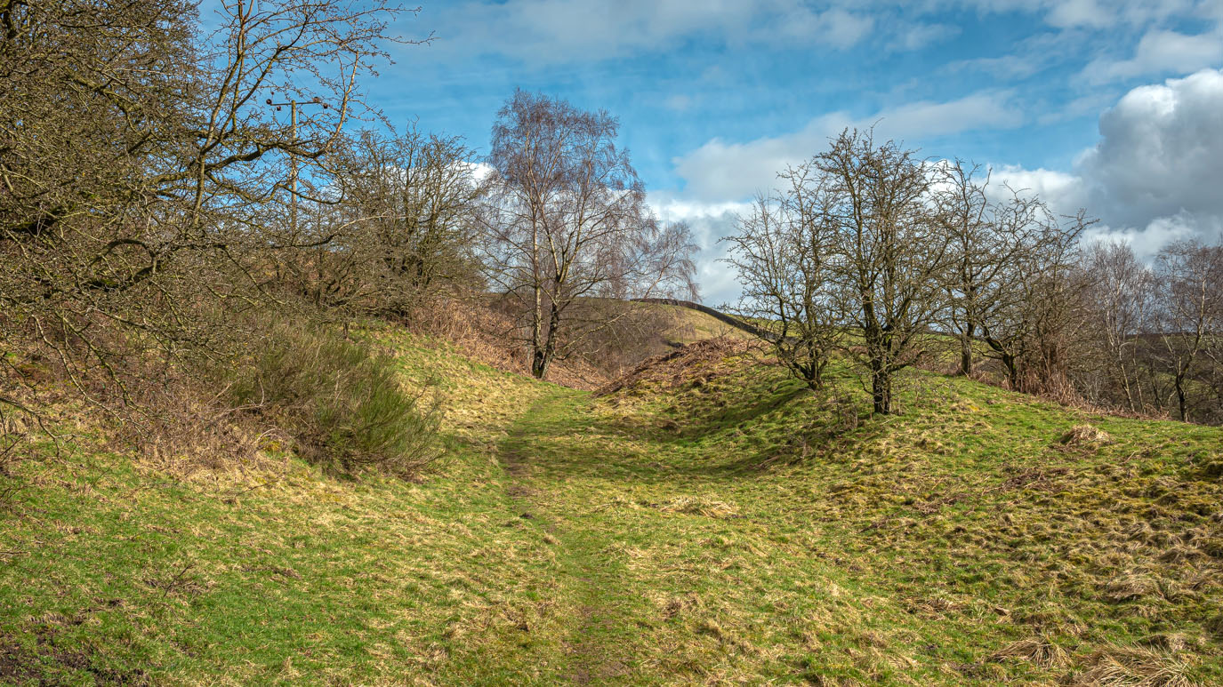
| The access track to Bottoms Farm with Slippery Ford and Keighley Moor in the distance |
 |
| Looking back down Dean Beck from Bottoms Farm |
 |
| The narrow muddy track just beyond Bottoms Farm |

 |
| Approaching Grey Stones Farm |


 |
| Grey Stones Farm |
 |
| Just when you think you've seen every conceivable type of stile.... |
 |
| Slitheroford Farm behind the trees and Middle Slippery Ford Farm (right) |
 |
| Approaching the slippery ford that gave the settlement it's name. The walker in the field beyond later told me he'd slipped and ended up sitting in the middle of the stream, when I caught up with him. |
 |
| The ford is at the point where Morkin Beck and Far Slippery Beck join to become Dean Beck. It was running quite fast and deep after recent rain and it was difficult to find a convenient place to cross. In the end I just gritted my teeth and crossed near the gate but the water came over the top of my boots. Thankfully, I managed to stay upright. |

 |
| Approaching Slitheroford Farm |

 |
| Previously, I hadn't been able to figure out where the path went from here, as it goes straight through the farmyard and the stile at the other end isn't visible from the road. Coming the other way today, it was obvious. |
 |
| Slippery Ford Lane |
 |
| Far Slippery Ford Farm And Middle Slippery Ford Farm |
 |
| The access road to Keighley Moor Reservoir with a large boulder on Trap Nook Hill visible on the horizon |

 |
| Looking back towards Slippery Ford from the boulder on Trap Nook Hill |
 |
| Scotland Hill with the wind turbines on Ovenden Moor in the distance |
 |
| Keighley Moor Reservoir |

 |
| The view from the dam wall |


 |
| A feeder similar to the ones my Dad used to use for hay to feed the sheep in winter |
 |
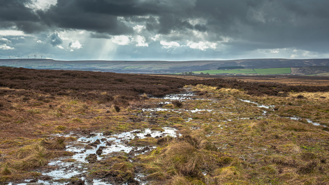
| Oakworth Moor |
 |
| Top Withens is just visible far right. In the foreground is a grouse shooting butt |


 |
| Sand Pit Hill |

 |
| Looking across Oakworth Moor, Wainman's Pinnacle and Lund's Tower can be seen on the near horizon |


 |
| A disused stone quarry |
 |
| The Grouse pub with Haworth and Penistone Hill beyond |
 |
| Lower Laithe Reservoir and Stanbury from Hare Hill |

 |
| Hare Hill |
 |
| Tewitt Lane |


 |
| Dry Clough Farm |

 |
| The memorial to the crew of a Royal Canadian Air Force Wellington Bomber who were killed when their plane crashed here in fog on 2nd January 1944. |


 |
| Pickles Hill |


 |
| Higher Turnshaw Farm |
 |
| Looking towards Stanbury from Higher Turnshaw Farm |
 |
| White Lane (left) and Turnshaw Road |

 |
| High Hob Cote Farm from Turnshaw Road |
 |
| Derelict farm on Turnshaw Road |
 |
| Grey Scar Road into Oakworth |
 |
| Griff Wood |
 |
| House on Colne Road, Oakworth |
 |
| Colne Road with Oakworth Hall on the corner |
 |
| The end of a good walk |


No comments:
Post a Comment