 |
| Ponden Kirk is thought to have been the inspiration for Penistone Crag and the Fairy Cave in Emily Bronte's Wuthering Heights |
Distance: 7.5 miles
Ascent: 1400 ft
Ascent: 1400 ft
Walking: Andrew
Weather: Sunny then clouded over later. Cool.
OS Map: OL21 - South Pennines
Starting point: Main Street, Stanbury
Photography: Andrew using Nikon D750 / Nikon 24-70 mm f2.8
Another amazingly varied walk from Stanbury. Being a sunny day at the weekend, I decided to avoid Top Withens and concentrate on the Worth Valley.

 |
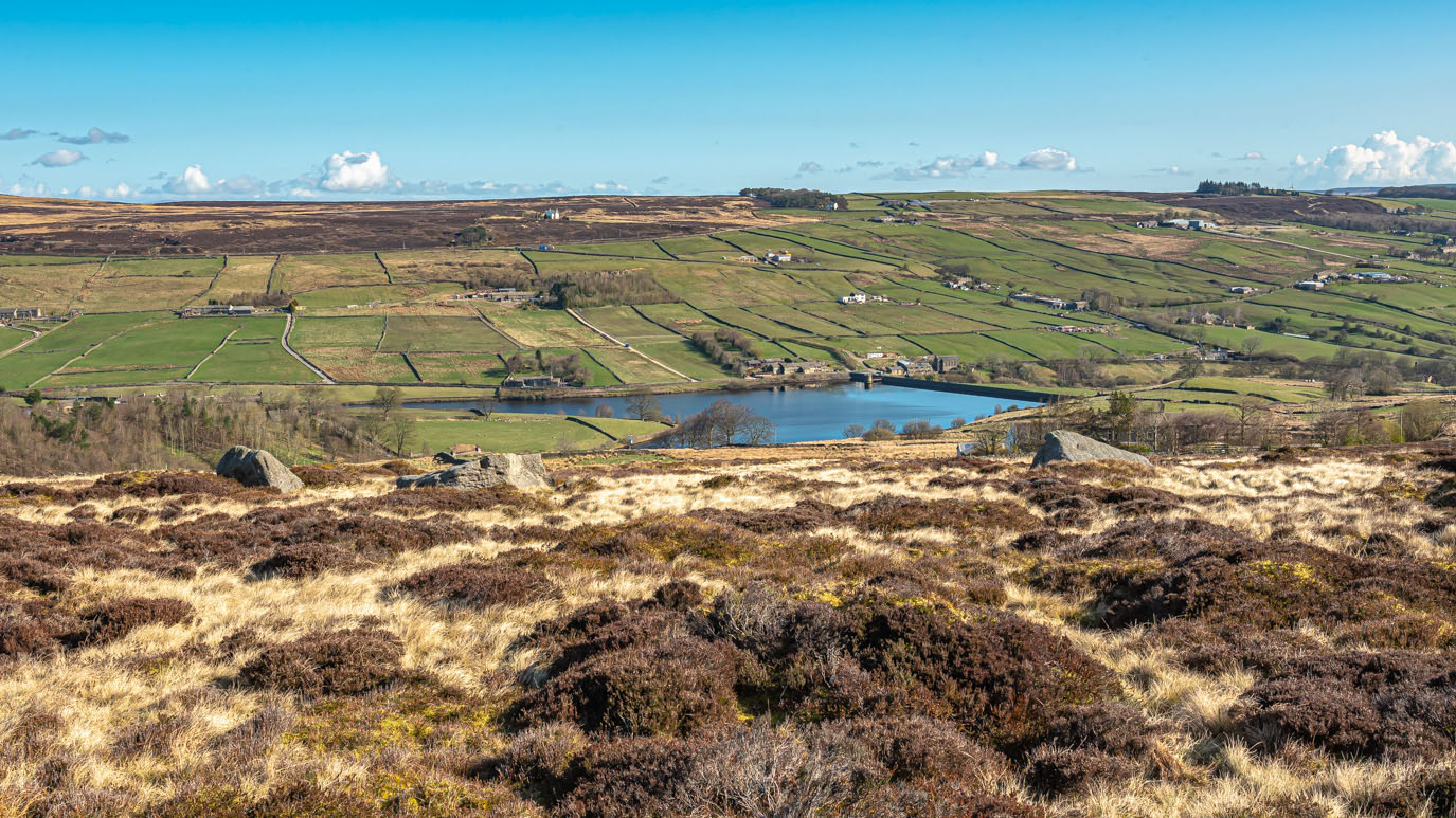
| After climbing up Back Lane past Bully Trees Farm, I found myself surprisingly breathless so it was a good excuse to look back down the hill towards Stanbury and Lower Laithe Reservoir |


 |
| Lost gloves are a common sight when walking round here but they don't often come in pairs |
 |
| The route I was following would take me across Oakworth Moor, behind the white house in the distance |
 |
| Lower Height Farm |
 |
| Having turned off the main Top Withens path and over a couple of stiles, I approached Upper Heights Farm |
 |
| Ponden Reservoir from just above Far Slack |
 |
| Approaching Master Stones |

 |
| Ponden Reservoir from just below Master Stones |
 |
| Master Stones |
 |
| Looking across Ponden Slack and Oakworth Moor from close to Birch Brink |
 |
| Oldfield and Oakworth in the distance from Birch Brink |
 |
| Ponden Reservoir again |
 |
| Looking ahead to Ponden Kirk, the rocky outcrop near the horizon, from Birch Brink |
 |
| Looking across Ponden Clough, deep ravine in the distance is Dean Clough, with Oakworth Moor beyond. |
 |
| A zoomed-in view of Dean Clough with Crag Bottom just to the left of it. I will pass these later on this walk |
 |
| The path ahead across Birch Brink then down Ponden Clough and below Ponden Kirk is clearly visible. Having taken the top path over Ponden Kirk a few weeks ago, I decided to take the lower one today. |
 |
| Looking back down Ponden Clough to Ponden Reservoir, Oldfield and Oakworth |
 |
| Ponden Kirk from Birch Brink |
 |
| The path I'd just come along is the one on the right. I've never dared tackle it before because the drop to the left is pretty severe but coming the other way, you don't notice it as much and it isn't too bad. It's certainly worth it for the views, although I wouldn't do it when it's wet. |
 |
| Halfway down a set of very uneven steps with a none-too-helpful handrail, the view really opens up. |
 |
| Ponden Kirk from the lower path |
 |
| Presumably, this mini-dam was built at the same time as the reservoir to control the flow of water coming off the moor |
 |
| Ponden Kirk from below |

 |
| On top of the dam. That bridge has seen better days. |
 |
| If you look carefully, you can see the tricky steps down the clough on the left |

 |
| Ponden Slack |
 |
| Looking back across Ponden Clough. On the horizon to the right of the sign are Lower Heights Farm, Upper Heights Farm (in front of the plantation and Master Stones on the far right, which I'd passed earlier. |
 |
| Ladder stile above Whitestone. Dean Clough is getting closer |
 |
| New Laithe Road with the farmhouse at Old Snap in the foreground and Scar Top in the distance |
 |
| Dropping down to Whitestone |

 |
| A lovely old stone gatepost with slots for cross-rails, rather than a gate |
 |
| The robin on top of this stile at Whitestone was singing its heart out so I stopped and watched it for a while. |
 |
| Far Dean Fields Farm, seen from Whitestone. This short section is part of The Bronte Way. |
 |
| Looking back to Whitestone Farm |
 |
| Over the stile and left onto The Pennine Way |
 |
| Heading down The Pennine Way to the North Western end of Ponden Reservoir |
 |
| Silver birch trees on the edge of the reservoir |

 |
| This grey heron didn't seem at all bothered by me and I got quite close to it. |
 |
| The River Worth |
 |
| Ponden Reservoir |

 |
| Far Dean Fields Farm |


 |
| I was fascinated by this ruined barn at Far Dean Fields Farm. There are loads of these around here. |


 |
| The view over Throstles Nest up The Worth Valley |
 |
| Looking back over the reservoir to Ponden Hall with Lower and Upper Heights Farms on the horizon |
 |
| Dean Clough |

 |
| Dean Clough - note the discarded car seat |
 |
| Crag Bottom |
 |
| Daffodils at Crag Bottom |
 |
| The view across to the reservoir from Crag Bottom |
 |
| An old quarry access road up to Crag Top |
 |
| A long-abandoned stone quarry at Crag Top |
 |
| Seems I'd climbed quite a way. Still a fair bit to go, though. |


 |
| I wonder how long that's been there - and how it got there |


 |
| The Pennine Way continues - uphill... |


 |
| The vast expanse of Oakworth Moor |

 |
| Turning off The Pennine Way, can you spot the path? No, neither could I. |


 |
| I know what you're thinking but this is another one |
 |
| A reminder, if it were needed, that life up here can be harsh |
 |
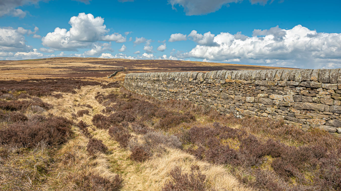
| The path follows this wall right into the distance |

 |
| Quite a long section here was extremely boggy. At this point, there was no way round it so I had to just plough on, sinking beyond the top of my walking boots and soaking my feet and legs. |

 |
| Back the way I'd just come towards Burnt Hill |

 |
| Across the Moor to Daisy Mount (the white house) |

 |
| Another very boggy bit at Highfield Farm |
 |
| Looking back from Highfield Farm |
 |
| Looking back over the reservoir, Ponden Hall and, in the distance, Ponden Kirk can be seen. |
 |
| Oldfield House Farm with Stanbury and Penistone Hill beyond. |

 |
| Primroses at Oldfield House Farm |
 |
| Manor Farm, Oldfield |
 |
| Manor Farm, heading down to the river |
 |
| Make-do and mend gates |
 |
| Stanbury and Penistone Hill |
 |
| The rickety old wooden clapper bridge over The River Worth |


 |
| I'm told the bridge was originally painted white. It's very bouncy to cross and the main beam is rotting quite badly |
 |
| The support strut on this side doesn't reach the ground any more and the left hand one is also broken |
 |
| Looking up the valley, the chimney of the ruined Griff Mill is just visible in the trees. |


 |
| Welcome to Stanbury |

 |
| Looking back across the valley to Oldfield |
 |
| Welcome to Stanbury |

 |
| The church of St Gabriel, Stanbury |
 |
| The old smithy and Horton Croft, the Quaker burial ground, were 45 burials were carried out from 1656 - 1718. I had a very interesting conversation about the history of the village with an elderly gentleman here (Mr Cole, I presume) who's joinery workshop is next door to the old smithy. |


No comments:
Post a Comment